25 June, 2006

London Loop Stage 2 – Bexley to Pett’s Wood


london loop sign Posted by Picasa Bexley – a borough of many surprises. Bromley – the London Borough

What happened to Stage 1? I haven’t done it yet as the leaflets are not available. It was only a chance encounter in Bromley Library that got me the leaflets for stage 2 and 3.

Firstly, although the London Loop is a loop and not a circle (one cannot cross the Thames at Erith unless you have a rowing boat) the promoters insist this stands for London Outer Orbital Path. Not only is this tautologous (London is repeated) it is incorrect grammatically: it should be Outer London Orbital Path (OLOP), but I suspect the name was made to fit the acronym.

I also realised that this walk will be challenging, not just in terms of distance travelled and terrain but also getting to the beginning and end points. Many of the stations are not very accessible from Bermondsey and busses can be very slow. I need to get up very early! Also some of the signage is non existent.

Bexley is a pleasant village with almshouses and a charity antique shop! It still has the atmosphere of a village and a traditional camera shop, traditionally closed on Sunday. I soon left the village behind, joining the Cray Riverway which is the London Loop for this section. I passed a cricket field but the match was over for the day and the cricketers were going home. There was also a family with a well thumbed Loop guidebook, although I soon left them behind as I crossed the landfill site and walked down to the River Cray. ‘Here be Parakeets’ said the guide and sure enough I saw one, in its colourful plumage. There were also equally colourful dragonflies flying around. As it was a fairly warm day, although dull, lots of people were out on walking with their dogs, and it looked to be an amusing thing to do to have the dog race through the river, whether tempted or not by a tasty morsel of meat! I lost count of the number of dogs being exercised and cooled off this way. The first feature I photographed is the five arched bridge over the Cray with a weir.
five arch bridge Foot's Cray Meadow Posted by PicasaFoots Cray meadow is a pleasant spot for walking, picnicking and taking the air and is very well used for these purposes. The walk continues by the Cray until it reaches All Saints Church Foots Cray.
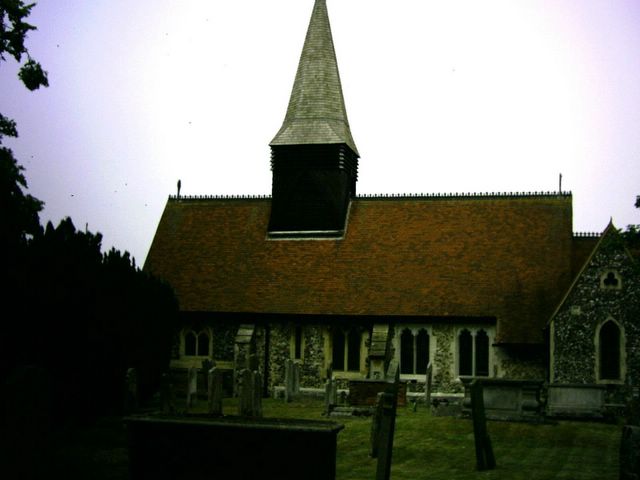
All Saints Church Posted by PicasaThis is an ancient church from 1330 although altered in the 19th Century reached from its Lych gate by an avenue of small yew trees. I was not able to see the interior but it has many historic artefacts.

As this is the beginning of the Cray Riverway there is a commemorative post carved with bulrushes to mark the occasion.
Cray riverway starting post Posted by Picasa

Arthur Mee says that Foots Cray has thrown away its loveliness but I’m not sure how much it had. There is a private school there with the motto ‘While ye have light, believe in the light, that ye may be the children of light’ around its clock tower.
Believe in the light Posted by PicasaThere is also an old black and white house in the high street
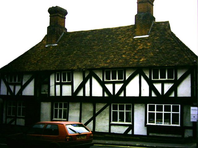
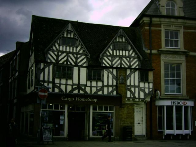
Black and White House Foot's Cray Posted by Picasa and a view of the coca cola™ bottling plant that was famous for taking tap water and selling it as Dasani. I walked past the crumbling grandstand (well not very grand) of Cray Wanderers Football Club and some overgrown allotments to come out onto a hill with a pitch and putt course and three giant redwoods. In California (where these trees are native) one of the trees has a tunnel cut through it and one can drive a car through it. These trees could have a tunnel cut for a bicycle or mopèd. This is Sidcup Place and there is a mansion
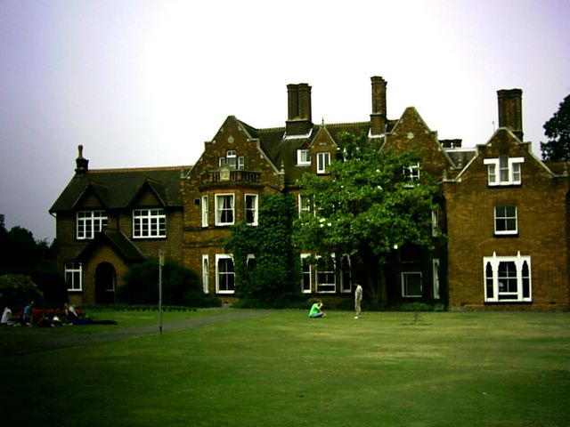
Sidcup place Posted by Picasa with a beautiful walled garden, full of lavender, roses and other flowering plants. I pressed on across the Sidcup Bypass via tunnels under the roundabout and entered Scadbury Park. This was where the signage almost stopped but I managed to get through the fields and woods towards the old moated manor house of Scadbury.
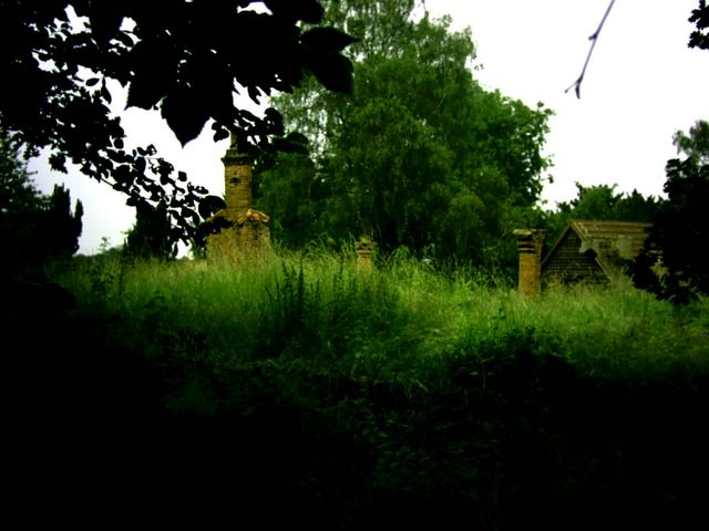
Scadbury moated manor Posted by Picasa Very much a picturesque ruin it needs an artist to paint it. There were two wells, one on the other side of the moat so this must be the well of loneliness.
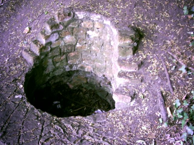
The well of lonliness? Scadbury Posted by Picasa After seeing this romantic spot I got rather lost in the Oak and Birch woods of Scadbury Park. Eventually I found Paul’s Cray Road and crossed into National Trust land at Pett’s Wood. I looked for and missed the William Willets sundial. Willets was a London builder and madman who wanted more work from his men (according to one story) or who wanted to play golf later in the evening (according to another). Instead of getting up earlier and doing all his work so he could go home early he had the hair brained notion of setting the clocks forward by 80 minutes in summer and back by 80 minutes in autumn. This scheme was later modified and adopted by Lloyd George during the first world war and has continued ever since.

Daylight Saving Time does not save one second of daylight!

The sundial is marked only in Daylight Saving Time.

I did see a commemorative stone in Pett’s Wood to the person who prevented development of the wood.
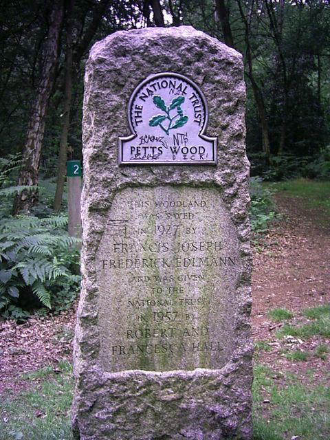
Pett's wood memorial stone Posted by Picasa Pett’s wood has substantial suburban houses as per the picture,

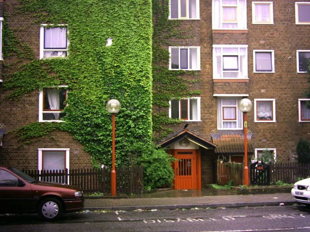
Suburbia - Pett's Wood Posted by Picasa and no doubt substantial suburban residents. The public houses were filled to bursting with football fans so I had a take away from a kebab shop where I got a moderately good kebab.

24 June, 2006

A visit to the Crays

A quick look at St Mary's and St Paul's Cray. Not as interesting as I thought but may edit this later


old house St Mary Cray Posted by Picasa

21 June, 2006


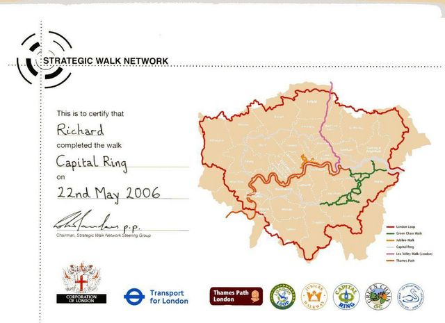
My certificate to show I've completed the ring! Posted by Picasa

19 June, 2006

Happy Hampstead

A Sunday walk from Golders Green to Hampstead, taking in some parts of the heath I never knew.

Golders Green is a suburb based on the crossroads of Finchley Road and Golders Green Road. Home to an important London Jewish community I went on Sunday so the shops would be open. Not all were so maybe a Saturday visit would also be worthwhile.

Golders Green is also home to Hampstead Garden Suburb. The Suburb (note capital S), as it is known to its intimates, is an experiment in town planning initiated by Dame Henrietta Barnett and planned by Parker and Unwin, pioneers of garden cities.

Dame Henrietta was the wife of Canon Barnett, who had a parish in Whitechapel. She envisaged a co-operative community of all social classes in a well planned environment which was within a 2d tube ride of central London. After much opposition, which seemed to centre on the fact that she was a woman, she persuaded the landowners to sell the land and allow it to be developed by both copartnership societies (fully mutual housing co-operatives) and private development. This development was strictly controlled aesthetically by Parker and Unwin.

Now the suburb is home to the rich and super rich with cottages for sale at around 250K and the Bishops Avenue containing the highest priced dwellings in London. However anyone can wander at will through the woodlands and open spaces and the townscape is still enchanting. The model for inter war council estates it has flourished!

Famous residents included Barbara Windsor, the blonde beauty of carry on films who lived in previously in Golders Green.

The Heath Extension is an open space dedicated to field sports, which gives on to tranquil woodland, although a group of people indulging in bicycle motocross were told off by one of the Corporation of London staff as I went through. There were ponds with yellow flowers growing in them.

I came out of this section at Spaniards Lane and took a picture of the Spaniards Inn. The inn has associations with Dick Turpin the highwayman and is ideally situated as the two lane, excessively busy, road narrows where the inn is. A good piece of business planning on the innkeeper’s part. I did not call at the inn but walked to Kenwood House. There is an 18th Century Bath house here fed by a chalybeate spring which English Heritage restored a few years ago. The water looks rather murky, perhaps it needs people frolicking in it to keep it fresh.

The grounds of Kenwood were crowded so I left there and walked on the heath for a bit, pausing to admire the views of Canary Wharf and the Gherkin, both clearly visible. I walked down to the actual chalybeate spring on the heath.
Chalybeate spring Hampstead Heath Posted by Picasa Chalybeate is iron water, with a few other minerals and is the same type of water that feeds Tonbridge Wells.

There’s no reason not to walk past the men’s bathing pond so I did- a bevy of beauties. Originally part of the Fleet river the bathing ponds are a bit cold for my taste but the views are good.

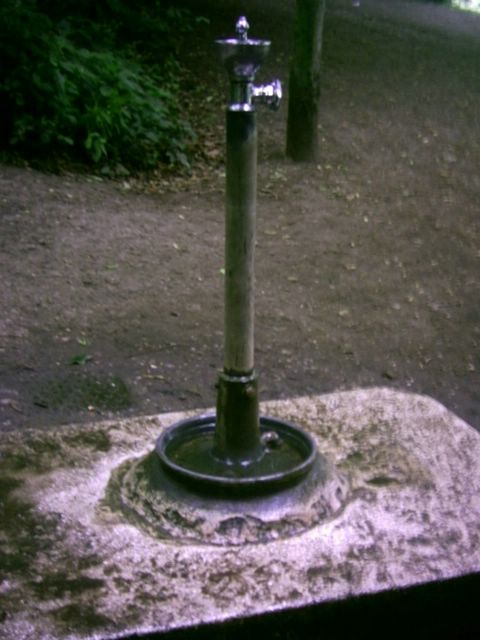
One feature of the heath is that there are drinking fountains. As the song goes, There are drinks and girls all over London- I can direct you to the drinks- and here one is.
There are drinks and girls all over London- here's one of the drinks Posted by Picasa

Having got a bit lost here I ended up near Hampstead Heath Railway station, so decided to walk up through Hampstead. I walked past the house occupied by the Poet Keats, before he set out on his final journey to Italy, and past the proprietary chapel of St John, Downshire Hill. This is the only proprietary chapel in London and was built in 1818 for the posh residents of the surrounding area. I wanted to take a picture of this small, pretty but imposing church but there was a police line and a tent nearby and I’m not prepared to risk arrest for taking photographs at a crime scene. The church will be there a long time after the police have left.

Another building on Downshire Hill is stark in its modernity. The Hopkins House is entirely glazed but hardly noticeable from the street. Built in 1975 it is uncompromisingly modernist.

Jack Straw’s Castle, another pub with highwayman associations (not the former home secretary Jack Straw) is now converted into luxury flats, and I was too tired to do a circuit of the Pergola on this part of the heath so I went home.

12 June, 2006

Greenwich Blackheath Lee and Lewisham

A Sunday stroll from Greenwich to Lewisham on a scorching hot summer day. Greenwich is a naval town which has been taken over by the University of Greenwich which occupies the former Naval Hospital. On a former visit I got told off for sitting on one of the chairs in the painted hall there. I couldn't see why as I was directed to another chair that was exactly the same. In the Chapel I could sit anywhere I liked. Greenwich has memorials of England's seafaring past with the preserved Cutty Sark tea clipper and Gypsy Moth IV yacht. I usually walk by the river at Greenwich but this time I walked through the Greenwich Royal Park, past the statue of General Woolfe and the planetarium (being rebuilt).


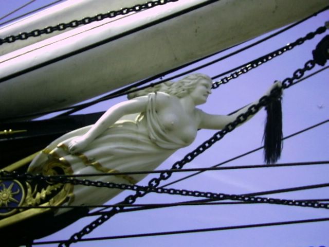
Cutty Sark Figurehead Posted by Picasa

Blackheath has the atmosphere of a village whilst remaining firmly a Victorian railway suburb. The church is orientated the wrong way for afternoon photographs so I didn't take one.

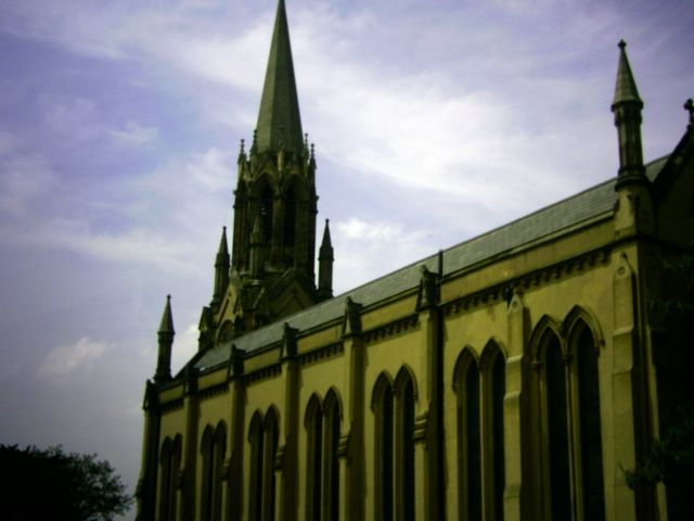
St Margarets Church, Lee is between Blackheath and Lewisham and the patron is the Lord Chancellor although I suppose it will be the Secretary of State for Constitutional Affairs now. The church is a commissioners church of thw 1840s (and it really is that orange colour). The spire is rather fine, and there is a visitor's centre for the parish.
St Margaret's Church Lee Posted by Picasa

A short walk led me to Lewisham town centre and the bus home but not before looking at Tower House Lewisham (see other blog for that)

10 June, 2006

Erith and Dartford

Erith on the Thames is an anagram of total and utter toilet – well, if it isn’t it ought to be. The town centre is a series of buildings separated by roads. The library (closed between 1:00 and 2:00) and town hall are separated from the shopping alley by a road. The church is also separated from the shopping alley and the library by another road. Even KFC ™ and the Working Men’s Club are separated from the rest of Erith by a road. There is no feeling of a town centre here. As you can see from the picture even Erith’s heritage – the most important things to a town – is slightly off. The picture shows a half tiled wall with door and a fire assembly point notice. Amazingly this is part of Erith’s heritage. Other towns would have demolished it as an eyesore but Erith sticks a plaque on it and says it was a fire station! I’m glad to know it still has a role in fires even if only as an assembly point. I suppose Erithians can go there if ever there is a fire and watch the destruction. London has a number of memorials to people killed in the blitzkrieg which are buildings left unrepaired after damage but these are now being replaced with plaques and other forms of monument. If this is a memorial, Erith, replace it, it’s not nice.

Erith Heritage Posted by Picasa

Erith was a Royal Naval depot in past days and fitted out the Great Harry, one of Henry VIII warships and the biggest ship of its day. There is a long pier on the Thames and this is a pleasant promenade for erithians although the views are not spectacular. The Thames is wide here and the views good from the new Morrisons which is separated from the rest of the town by roads.

While I was there there was some bellringing on 6 bells from the 160 foot spire of Christ Church. This church is Victorian and if there is an ancient church in the town I did not see it. Arthur Mee says there is a St John’s. Archbishop Tait called Erith the ‘darkest spot in the diocese’ and I can see what he means. I recall a previous visit where I saw the Edward VII coronation window in Christ church. It is a pictorial representation of the King at his crowning, and the church is worth a visit.

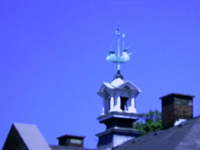
My other picture shows the weathership on the library which tells us where the wind is blowing. The library has been modernised (it is the gift of Andrew Carnegie so cannot be closed otherwise the Carnegie Trust will demand its money back) but the motto “Labour overcomes all things” together with the Erith coat of arms is worked into a mosaic in the porch of the library. The library is a grand building (perhaps I should do another blog of library pictures – there’s a thought!) still serving the residents of Erith who can cross the roads.


Erith Library weathership Posted by Picasa

Dartford.

Kent Market town with Coöperative Department Store. Some pretty intense competition from the new retail developments just off centre though. There was jubilation in the streets as England had won their world cup match against Paraguay, although if England can’t win against Paraguay (pop 2 million = 3.3% of UK Population) it really is a poor lookout. Dartford has a chalk and flint chequered church and the little River Darent runs into the Thames here. Wat Tyler, leader of the peasant’s revolt had a cottage here in 1382, and coming to more modern times Mick Jagger went to school here. Tesco want to build a new store on the public gardens here.

08 June, 2006

Cruising down the river on a Tuesday Afternoon

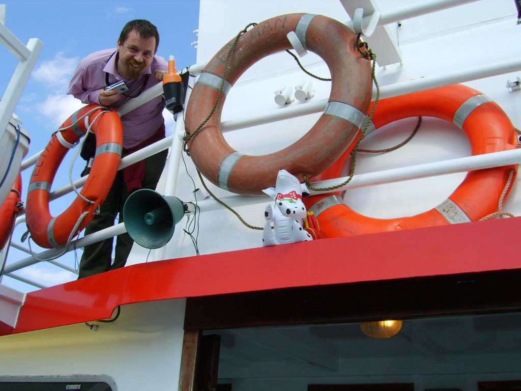
A delightful working awayday on board the Eltham, a Thames pleasure craft. My division at work left Waterloo Pier at half past ten and had a divisional meeting to discuss some issues. We followed this by lunch between Rotherhithe and Greenwich then a glass of wine between Greenwich and Woolwich. We passed by the Thames Barrier and up as far as Barking. In the afternoon we had a quiz on the subjects of music and london. My team came a credible third!


The weather was beautiful and I spent a lot of time on the open deck of the boat. If only all working days could be like that!

The picture shows me on the sun deck and was taken by Janet.

04 June, 2006

Hall Place, Bexley

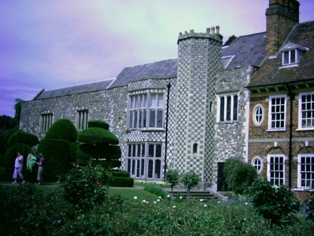
A visit on a beautiful day to Hall Place, which Arthur Mee said was at the end of a country lane, but that the motor age was encroaching. The motor age has now fully encroached with the A2 running alongside and the roar of traffic everywhere in the grounds. It is still slightly outside of Bexleyheath’s main shopping centre and can be approached through a park but the most common approach is by road. The house dates back to Tudor times and was the country retreat of a lord Mayor of London. It has romantic associations with the Black Prince who spent his honeymoon there. The picture clearly shows the two halves of the house. The tudor half in stone and the 17th century half in brick.


Hall Place, Bexley Posted by Picasa

Its current use is as a function suite for Bexley council where couples can celebrate marriages etc, a museum (in a small way) and a gallery for displaying works by artists. Most of the rooms, including those with very fine plaster ceilings are empty except for a few pictures. The Tudor house has two wings and a great hall, and the masonry of the walls is decorated in a chequered pattern. The newer part surrounds a courtyard. The house was owned (but not lived in) by Francis Dashwood of hellfire club (in)fame.

The glory of Hall Place is the formal and informal gardens with topiary work hedges (in need of trimming) and herb and sunken gardens. The River Cray runs through the grounds.

Bexley parks department also have their nurseries at Hall Place and they have model gardens of different sizes to assist the public with planning their own gardens. A welcome innovation.

31 May, 2006

Banbury- Oxfordshire Market town.

A visit to Banbury- but I didn't ride a cock horse to get there- more like a chiltern train.


A fine lady on a white Horse- Banbury Posted by Picasa

This is a rather nice market town in North Oxfordshire with a pretty market square and a pleasant (if small) museum although rather spoilt by the member of staff who admonished me at considerable length that no photography was permitted in the museum! The museum contained the acid embossed glass from the former Banbury Industrial Coöperative Society door so that was good- but I can't give you a photo of it.

The locals obviously don't eat after 3 as this is when all the public houses stop serving food and only a few serve after 5. Not very adventurous then. There was a curious church with a pepper pot spire and of course the famous cross which was erected only in Victorian times as the reformers pulled the old one down as a relic of superstition- perhaps it was! Banbury was a roundhead stronghold in the civil war and it seems to be pleasant if dull. It was a good day out and I didn't have to wait longer than 5 minutes for trains that day either.


Black and white house Banbury Market place Posted by Picasa

Pride in Birmingham and Leamington Spa

A bank holiday visit to Birmingham - Thanks Phil! - followed by a visit to Leamington Spa.

Birmingham pride was on this Bank Holiday weekend so I decided to go up. You can see pics on dontstayin.com. It was pretty poor considering it cost £10 but I did see my friend Richard and his mates and Mike and Tony were also up there.

All in all a good time.

Leamington Spa is a pleasant Georgian Spa town that really has seen better times and competition from Stratford on Avon and Warwick. The saline spring still operates but I can drink salt water any time. The library and museum are housed in an old swimming pool (the pump room) and the museum has a restored turkish bath and some water treatment rooms. Still a bit posh it has seen better days, the church is massive and was used while Coventry Cathedral was bombed out in the war. I couldn't get in though.


The highlight was Jephson Gardens, named after the doctor who promoted the Spa although the land was given by someone called Willes. This park contains a greek temple to Dr Jephson with a statue. It also contains a curious fountain in the shape of a parachute commemorating seven Belgian parachutists who were killed during hostilities. There are lakes and fountains and a tropical plant house (useful shelter from the rain) which has a saline fountain in it. The evidence that it is saline is that copper plated coins thrown in it go turquoise.
The worst thing about the park was that all the shelters were locked up with grilles. Similar to American jails. I would have thought that Leamington Criminals would be dealt with in Warwick but maybe I'm wrong. Maybe there is some kinky purpose to it. Certainly it is no help to anyone who wants to shelter from the rain.

22 May, 2006

Capital Ring walk 13, 14 and 15 – a mixed bag done over 2 days.

Ups and downs, success but not very good success: I have now completed the capital ring!

For walk 13 (and part of 14), Sunday 21st May 2006 I got to Stoke Newington, Cazenove road by a rather unpleasantly full bus. The walk is not well signed here with a few signs missing in the earlier parts of the walk, but what made this walk really unpleasant was the rain which came down in torrents when I was nowhere near a bus stop and dried up when I was. That and some of the depressing areas the walk leads through. April showers in May forsooth. Anyway I walked through some boring suburban streets peopled with patriarchal types, this being the Chassidic Jewish quarter.

As I entered a street called Springfield I saw a place I knew from College, Lea view House. I studied it for my housing management exams. It had been built in the 1930s as a slum clearance scheme with excellent amenities such as tennis courts for the tenants. It had fallen into disrepair and worse and was refurbished as a pioneer in community involvement. It looks as though it is still thriving. The Estate Manager’s name at the time of the refurbishment was Dick Head. You can get a film about it all should you be so inclined.


Lea View House Posted by Picasa

Springfield Park of 33 acres looked very pleasant and I’m inclined to go and do this walk again (from there) as there was a park café and (allegedly) a conservatory and bandstand all with views towards the River Lee. Rain rather stopped play here so I just carried on across the River Lee by bridge where I could not get my camera and gadget bag through the bollards. A really portly person could not have done it at all – is Lee Valley Regional Park fattist? I walked through the Walthamstow Marshes blinded by the rain and sheltered under Railway arches which were where A V Roe made the first all British powered flight in a triplane, the Yellow Terror, in 1909. This is commemorated by a plaque which I could not see. The next part of the walk past a trim track in a local park was closed but with the fencing down and already wet through I decided to chance it. The Middlesex water filter beds were on this stretch, which is something else I’d like to see but had to give it a miss.

I passed Hackney Marshes with its 80 football pitches and the Lesney Matchbox toy factory (which does not seem to be used for that anymore) on the river at Homerton Road. Here the rain got so bad I left the route to wait for a bus but no bus came and the rain eased off so I just carried on. The Lee here is broad and wide. Inconsistent spellings are intentional – natural features are lee, manmade are lea. Who am I to argue with the Park Authority?

The Eton Mission Boat house commemorating Mr Johnstone was built in 1934 and still provides rowing and canoeing facilities for east Londoners.


Eton Mission Rowing Club Posted by Picasa

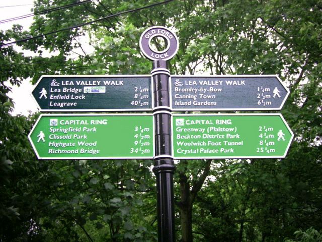
I missed the turn off the route here and carried on to do part of Walk 14. I walked past the junction with the Hertford Union Canal where a new block of flats has been built. Quite nice! Continuing (still in the rain) to Old Ford Lock there was a party, which appeared to be doing the route in the opposite direction (widdershins).


Capital ring sign old ford lock Posted by Picasa

I then went onto the Greenway, which is really the mound that covers the Northern Outfall Sewer which discharges London’s waste water into the river for carrying away at high tide. Designed by Joseph Bazalgette in the 1860s like all London’s waterworks they are still doing the same job as they ever did for a larger population that likes getting washed more often than their ancestors did, and has more baths, basins and toilets than the were the norm in the mid 19th century. It’s all rather a strain. Investment in new supplies now please – and Ken that desalination plant sounds attractive, although you want us to grow cactuses in our window boxes. Let it through!!


This path went through an area of rubbish dumps and dirty industry, most of which backed the bid for London 2012. I suppose their businesses are worth more as land for development than the business is worth. Pity, because if we can’t add value to something we can’t afford anything.

I left the walk for that day at Stratford High Street.

As the next day 22nd May 2006 dawned bright and sunny towards the East I headed off again to Stratford to rejoin the walk. Unfortunately it dulled in again so although not as bad as previously still pretty grim walking. At the start of today’s walk was a block of flats called Albert Bigg Point. Does this person live in the block? If so can I meet him?

There was a human sundial set into the ground on the meridian line. I could not check it for accuracy due to lack of sunlight!

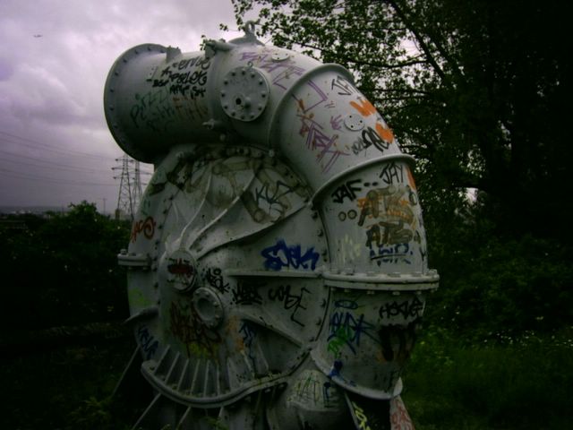
I crossed some of the Bow Thames Backwaters- navigable rivers to the Thames and passed Abbey Mills Pumping Station built to pump sewerage from the Northern Outfall sewer to the Thames. This was a curious blend of large Victorian house with an ornate porch and a public building of some sort with a Moorish turret. Moorish seems to be an architecture well used for sewerage. At the Channelsea river there is this piece of sculpture – part of the machinery from Abbey Mills.


Machinery from Abbey Mills Posted by Picasa

The Greenway is not interesting walking although I did have to use my ingenuity to scramble over some pointed poles to get out where Newham Parks Dept had not unlocked the gate at one end of the strip. I checked my trousers and there were no punctures, I’m pleased to say.

After the greenway the walk led me to a view of Beckton Alps. Beckton was named after Beck, chief engineer to the Gas Light and Coke Company (the GLCC), who laid out a new town around the refraction plant. Superseded by North Sea Gas in the 1970s this became redundant and the Beckton Alps are the slagheaps from the plant. They do look like Alps though. After this I went into Beckton District Park with loads of waterfowl all with chicks. Two swans with three chicks, several geese with many chicks. Not that all will reach maturity but a lot will. The park was pleasant enough with identified trees and moderately well kept. I decided to go on to Walk 15 to finish what I began three months ago.

This was by far the least interesting part of the ring. Most of the walk was in scrubby parkland or housing estates, even the bits by the river with good views were not so interesting.

I did visit the University of East London Campus but rain again stopped play there. However wonderful it is it will never be great in the driving rain. The views from the riverside included the RACS former central premises clock (You’ll have to visit my other blog to see that one) and the free ferries. The day was against me for seeing the railway museum at North Woolwich (once part of the Borough of Woolwich) as this only opens on weekends.

The Woolwich Foot Tunnel was opened in 1912 and confusingly has two entrances: one for stairs and the other for lifts. I took the lift, although unlike the Greenwich Foot Tunnel these lifts are small and have no seats in them. Perhaps the Woolwich Tunnel was built when the Moderates were in power on the LCC and the Greenwich one when the Progressives were in power.

The Picture shows the gloomy Woolwich tunnel.


Subterranean Gloom- Woolwich foot tunnel Posted by Picasa

I completed the walk with a sigh of relief. For a moment I reflected on the walks I would do again. Certainly 4, 7, 12 and 13 which have been the highlights. Never again will I do 14 and I probably won’t do 9 again either.

Now for the London Loop…

21 May, 2006

Manchester, Stockport and Hazel Grove.

A visit to Manchester for a day to attend the Coöperative Group Annual General Meeting led to a day out with Mike and Tony to look at the coöps in and around Stockport, by bus.

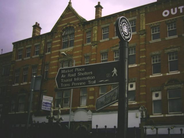
Stockport is dominated by its viaduct and the Coöperative Bank pyramid call centre building. There is also a hat works museum (!) and as you can see from the picture it has air raid shelters. Does Stockport council know something that we don’t? Are they expecting an air raid? Shouldn’t they share their intelligence with the rest of us?


Stockport takes air raids seriously Posted by Picasa

Stockport also has a very fine coöp department store, formerly United Norwest Society’s Central Premises and now owned by Anglia Regional. Unfortunately I can’t show you any pictures of the store as the loss prevention officer told us not to take any pictures of the store from the street (and I will never take pictures inside a store). I wasn’t sure though if the person was the loss prevention officer as he did not have any form of identification.

Hazel Grove suggests images of a rural idyll amongst the hazel trees. The reality is somewhat different. The rural idyll has gone brickily industrial, a long, busy and dirty street and a very uncared for air. The Coöperative superstore there looked somewhat dated and the Coöperative Bank ‘tardis’ kiosk had been vandalised to death, the screen on the ATM had been booted in (still working though), all the lights had been put out rather unpleasant graffiti had altered the sign ‘Telephone Banking’. A rather dismal place all told.

14 May, 2006

Highgate to Stoke Newington- the old straight track

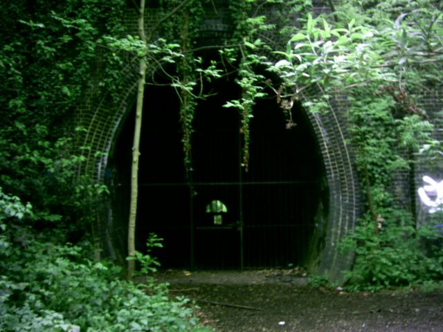
Walk 12 of the Capital Ring began with a steep climb from Highgate station up to the Highgate Library (shut on a Sunday). Then the walk went down the road leading to the Archway, with a tantalising glimpse at that glorious arch before going down onto the old straight track of the parklands walk. You can see two locked and gated tunnels but you do not walk past these- you carry on to the right and walk towards the East.

highgate tunnels Posted by Picasa

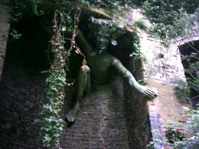
The track is London’s longest nature reserve and is home even to Muntjack Deer although I didn’t see one. The track has artworks installed, both officially and unofficially. An official one is the figure of a spriggan emerging from the old brickwork outside the former crouch hill station. Spriggans were said to steal human children and leave baby spriggans in their place!


the spriggan Posted by Picasa

The track crosses Tollington Park, which is where, at No. 63 Miss Eliza Barrow was murdered by Frederick Henry Seddon, called by some the meanest murderer of all time. He poisoned Miss Barrow with using flypapers, but it is hard to have any sympathy for any of the participants in the case, although Seddon called on the Great Architect of the Universe when in the dock to try to prove his innocence. All rather too late as he was hung.
After crossing the East Coast Main Line I entered Finsbury Park where I was surprised to find Jason Beazley and a friend of his, Greg, cycling through the park. We passed the time of day. Jason had been going to work but wasn’t going to make it on a bicycle that day so was going home.
Finsbury Park was quiet and, in keeping with London park names, is 3 miles from Finsbury. Southwark Park is also in Rotherhithe not Southwark although it is in the Borough of Southwark. But a pleasant park none the less. The New River was next. I have walked by this in Hertfordshire at Cheshunt. The new river is not a river and it isn’t new. It is over 400 years old and is a canal designed to bring water to the capital from springs in Hertfordshire, a function it performs to this day. It looked quite full as did the reservoirs. I could not walk all the way along the river as the path was closed but I walked down Seven Sisters Road (which for some reason I translate into German – Sieben schwestern) and joined the new river again disturbing two rats in the process.
The reservoirs were home to bird life including a moorhen with chicks, a nesting swan some Canada geese with chicks and a heron, again the heron flew away before I could get a good shot. Rather camera shy are herons. Here you can see two geese with their goslings.


geese and goslings Posted by Picasa

The path came out at the castle, a former pumping station, and the next green spot was Clissold Park. Jason had warned me that Clissold Park would be busy and he was right. There were lots of people using the park and several drinking fountains in view of the reservoirs nearby I suppose. I drank at the fountain in memory of “three sweet sisters” aged one three and four. Clissold Park is very beautiful with lakes and flowering trees, all dominated by the massive spire of George Gilbert Scott’s St Mary’s Church. The Mansion in Clissold park holds a café and I had a fairly nice burger here! The walk led on by the little 16th Century church, also dominated by the 19th Century one. I had a peep into the old church but something was going on in it so I didn’t go further. The fine 1930s Stoke Newington Town Hall is now just relegated to offices for Hackney Council but Stoke Newington Church Street is fine with lots of cafes and fair to lousy bookshops with surly assistants or maybe they were their proprietors. I was impressed with this street and it seems like one of the nicer parts of Hackney.
Leaving Church Street behind I entered Abney Park Cemetery, where William Booth founder of the Salvation Army is interred and where Isaac Watts has a memorial (although he is buried with other great dissenters in Bunhill Fields). The ruined chapel (including ruined outside toilet with pointed window) looked rather sad, I hope the trust can restore it. The cemetery as a whole was very overgrown and luxuriant. Over 300000 people have been buried there. One of the graves had a racehorse with a horseshoe over it, one had a lion couchant and yet another had a bicycle on to commemorate a record breaking feat of cycling. The Cemetery and the walk ended at Stamford Hill. A very quiet walk with some pleasant scenery and only 12 miles to Woolwich!!