07 July, 2006

Walk 4 of the London Loop – West Wickham Common to Hamsey Green

This is the first walk done using the guide book to the loop. Unfortunately this guidebook is very hot on HOW you do the walk (turn right at the gate, left at the hollow oak tree etc.) but very poor on WHY you do the walk (beautiful old church here, mansion home to the earl of oxford in Elizabethan times there etc.). I suppose it makes me refer to my books. There is also a website (http://www.longdistancewalks.com/london_loop/index.html) which gives a description of the walk as a pub crawl and walking conditions. The author is also rather sniffy that the loop is a recreational path. What does it matter? I do not do these things for the sake of the walk and the beer (although a shandy is welcome on hot summer days) but for the views and the interesting things one sees in the country. The fact that exercise is involved is a bonus!

A late start led to a late finish and I didn’t get to start walk five which I had intended as I was just too tired. This was only so that I would not be at the mercy of the bus service and could get a train home. As it was that didn’t matter.

I started at Hayes station and walked by the unofficial link to the start point at West Wickham common via the Welcome store at Coney Hall, one of South London’s outposts of empire, where I bought a reduced Cornish pastie, some reduced raspberries and a bottle of orange juice. I stated the walk proper by following a suburban alleyway with a notice by the Beckenham Borough Council stating that various modes of transport were prohibited unless authorised and that, if authorised, they had to be ridden in such a manner that they caused no danger to the public. I understood the last part but wasn’t sure about ‘prohibited unless authorised’ which doesn’t seem to make sense. However, I entered the Coney Hall Recreation Ground and saw the stone (or is it a concrete bollard?) that marks the Greenwich meridian.


meridian stone Posted by Picasa

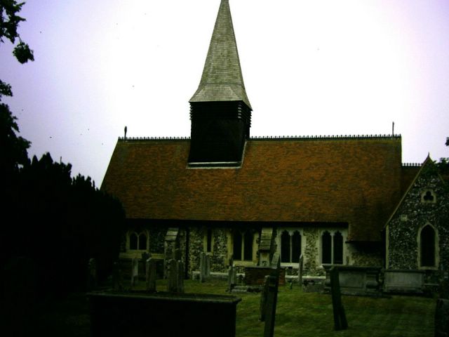
It is not very impressive as you can see and is painted a funny shade of green that looks a lot better in black and white. Passing by Wickham Court which was built in the 15th Century as a late example of a castle plan it is now a school for young gentlefolk but it was difficult to photograph as surrounded by walls and trees. St John The Baptist Church West Wickham has been on the site since Saxon times.

St John the Baptist Church West Wickham Posted by Picasa
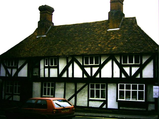
Since I was using church paths at this point of the walk it must be that I was using paths from Saxon times too. How many others have put their feet where I have I wonder? The church looked as though it had been altered in the 14th Century with a rather domestic looking addition, but was locked (as usual) so I could not see the 15th century glass, old tiles and old brass that Arthur Mee says is there. Leaving the church down a Saxon path I went into Sparrow’ Den Playing fields where I ate my raspberries. Suitably fortified I ‘sought the higher path’ in the words of the guidebook (no I didn’t die) and walked through the Corporation of London Spring Park and three halfpenny wood. I came across the stone that marked the boundary between the boroughs of Bromley and Croydon which was also inscribed with the words ‘London Outer Orbital Path 1996’ which commemorates the opening of the path. After walking through the woods I came to Shirley Road (very posh). I have just been reading about the Bermondsey Children’s Home which was built at Shirley in 1903 as a model institution for pauper children. Just before Shirley church (which looked interesting) I turned off to walk past the school and down another suburban street with pretty cottages in the Tudor style (not mock Tudor - much better than that) and then carried on after a good climb to the slightly vandalised viewpoint on the Addington Hills built to celebrate Croydon’s Milleniary year in the 1960s. There would probably have been a good view on a clear day but today was not clear so I could see Croydon and that was about it. Never mind. The restaurant looked nice but was as closed as the public toilets set into its side wall. Next I walked towards the Croydon Tramway and crossed this. The tramcars are coloured blood and custard (red and yellow) and I saw one coming round the bend on the track as I walked by it. Tramcars are yesterday’s technology imposed by a load of train spotters. Much better to have trolley busses which are much more flexible and less capital intensive with no rails to lay. The next high point on the walk was Heathfield House Gardens.

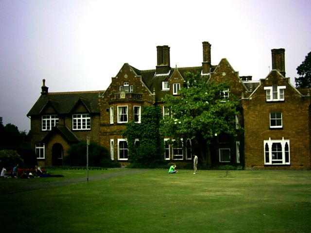
Heathfield House gardens Posted by Picasa
Heathfield House is a Croydon Council Training Centre and the farm is integral to the scheme of decoration. There is a pond and beautiful flower gardens and this would be worth a visit on a nice day. I spent some time walking around here and admiring the flowers. Onward to Bramley Bank Nature reserve and through this to Little Heath Wood, again open and quiet country within the London Boundary. Then through some of the dullest housing estates you could imagine into Selsdon Wood Nature Reserve, with a notice giving a stern injunction not to pick the flowers – as if! A peaceful walk coming out onto the boundary of London and Surrey – a little green lane called Baker Boy Lane.

The boundary between London and Surrey: London to the right Surrey to the left Posted by Picasa
I felt cheated by this – surely the boundary of London should be more spectacular than this! Where are the bronzes? Maybe a motorway? But no – a little green lane. I walked through it past fields of wheat and fields of cows crossing a road and passing an attractive brick farmhouse and its fields of sheep on another green lane. Passing within sight of a country house (unnamed in the guide book or the leaflet) and walking through a ploughed field and coming out at another big house the walk became suburban right at the end. Hamsey Green appears to be a pleasant village half in Croydon and half in Surrey and has a Coöperative Market Town store and an Alldays shop. If the weather had been better this would have been a really enjoyable walk!


Loop sign Hamsey Green Posted by Picasa

02 July, 2006

London Loop walk 3 – a day in the country!

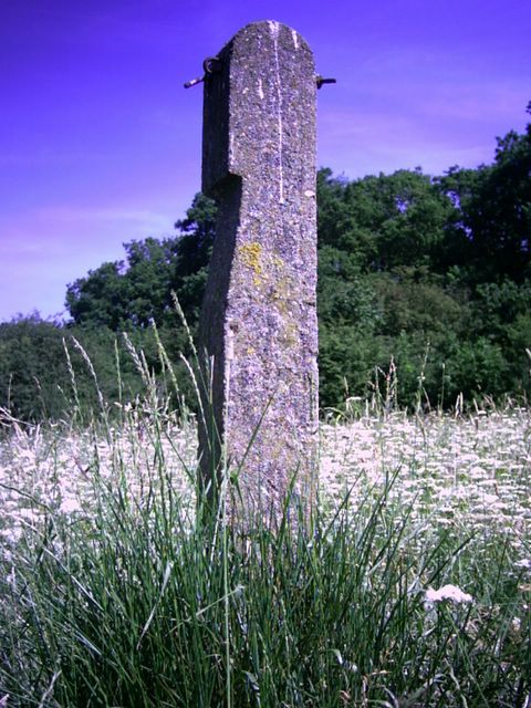
This whole walk takes place within Bromley – The London Borough. I began this walk at Pett’s Wood in the Jubilee country park. This was simply old fields and a former golf course preserved from development as a local nature reserve but it set the tone for a truly rural walk today, including village shops and pubs. I came upon this ancient monolith (old fence post) in the Jubilee Park by chance and thought it makes a good picture.


Ancient monolith Posted by Picasa

I then went down a long suburban street with some dignified council houses and some less dignified council tenants who stared and entered Crofton Woods. Crofton Woods are ancient woodland, and, unlike the walk by the Thames contained teasels although they were not mature. Arthur Mee does not mention Crofton Wood, so I can’t give you much background but they were very pleasant with very few people around. Crofton Village was supposed to have a sign but I must have missed it as I missed the church. Crofton seems to be omitted from Arthur Mee’s Kent guide so no background here either, but the path continued through Darrick Wood via a playing field and a meadow with a good view of the North Downs.

Crossing Farnborough Way I came to the village of Farnborough (Kent not Surrey). Farnborough has some lovely old buildings including its 17th century church (locked as usual) and a peace memorial in stone. Lord Avebury, who gave the people bank holidays as well as protection of open spaces and birds so we can enjoy them better, is buried in the churchyard although his tomb had to be removed after abuse by bank holiday picnickers.

Leaving the churchyard one enters open countryside and woods then I entered High Elms Country Park. This is where Lord Avebury lived. Although the house burnt down in the year I was born, the formal and informal gardens are now a country park for Bromley Council. I speculated on whether I should like to live in Bromley or not (but not if I could afford it) and it would be nice… I was soon away from the park and the golf course and walking through what claimed to be a restored orchard. I wasn’t aware of any fruit trees but it looked as though it had decayed again and needed another restoration. I passed this curious house with a clock on it.
The clock building Posted by Picasa

This is not mentioned in any of the guide books so I am at a loss as to its function. The next point of interest was Bogey Lane, a charming green lane between two fields. I felt quite like an ancient Briton and had to stop myself throwing off my clothes and painting myself with woad! The loop for some reason went into a wheat field so I faithfully followed it to the letter and photographed a field of poppies in the distance (if this comes out I’ll post it). Bogey Lane came out onto a charming country road called Farthing Lane.
Farthing Lane Bromley - The London Borough Posted by Picasa
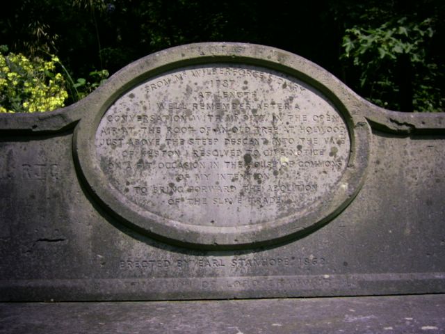
No one would expect a road like this to be in a London borough, so take my word for it that it is and how truly rural London can be. I passed by Holwood House at Keston, taking a picture. Arthur Mee states that one can wander through the grounds at will but the property owner appears to have changed this policy. In fact, the commemorative stone seat where Wilberforce debated abolition of slavery with Pitt has been locked and barred. Here is the seat's inscription.

Stone anti slavery seat Posted by Picasa
I saw a goldfinch in the grounds. Passing through Keston Common I saw Caesar’s well where Caesar's men had taken refreshment at a little spring.

Ceasar's Well Keston Common Posted by Picasa

As a raven guided them to it, the river for which it is the source is called the Ravensbourne. There are three ponds on Keston Common, which was busy with fishers and people enjoying the sun.

Source of the Ravensbourne, Keston Common Posted by Picasa

Keston village had a village store (thriving – while I was there one man bought £20 worth) and a pub called the Fox where I had a ginger ale shandy. I do not think the young barman had heard of shandy as he added ginger ale to a glass and topped it up with lemonade. I asked him if there was to be beer in it when he got the idea and made a proper one. Keston also has a drinking fountain (dry) on the common but I resumed my walk on the path to West Wickham Common and the end of this stage. The Corporation of London saved the common from development in 1892 but has some very odd byelaws. For example in order to take amateur photography I must have a licence from the Corporation. Not having such a licence I did not take any but I must remember to get one. The path led by an alleged Elizabethan (I not II) earthwork and some pollarded oak trees both alive and dead. This stage ended at the end of the common so I went home via Hayes.

30 June, 2006


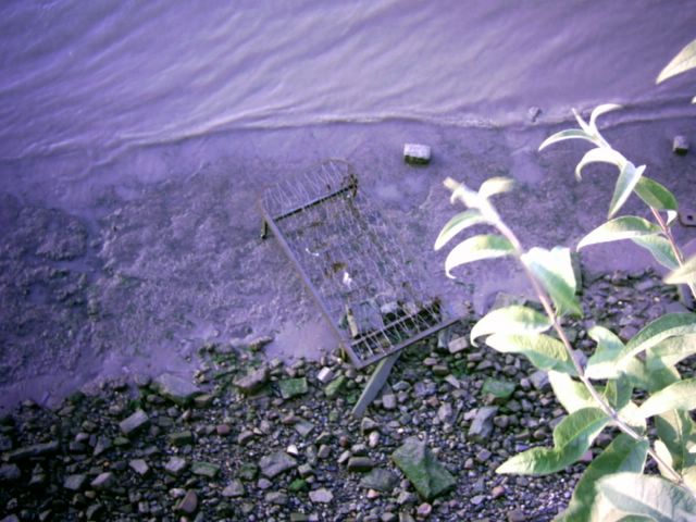
The River Bed!! Posted by Picasa

Erith to Old Bexley – First walk of the London Loop.

For general comments on Erith please see elsewhere but I have to pay tribute to the staff of Erith Library who supplied me with a photocopiable leaflet (for use in the library only) for this walk – you did me proud!

I will also state from the outset that this is not one of the most prepossessing walks you can do around London: the first section at any rate has scrap merchants, dealers in aggregates, civic amenity sites (that’s rubbish dumps to you and me) and roads crammed with lorries going along at breakneck illegal speeds.

It starts pleasantly enough by the Thames at Erith, and this plaque records the spot.
Loop sign Erith Riverside Posted by Picasa

After you leave the town, you go back towards the river passing industrial buildings busy with lorries (although not on a Sunday). Then, surprisingly you come out onto the London Flood Defence earthwork and walk along the top of this for a while, looking towards the Thames and the shipping, rather than the scrap yards and other industries here. I didn’t see any teasels as stated in the leaflet but the wild flowers were in bloom and looked very beautiful. There was also a view of the Queen Elizabeth II Bridge, the clockwise part of the Dartford crossing. Coming to the Darent, the river that runs through Dartford and joins the Thames here, there was another flood defence, which notices warned one to keep off. The tide was out so I did see lots of water birds feeding on the mud flats and some flocks of thrushes. The Cray is a tributary of the Darent, and this path is shared with the Cray Riverway. I walked up the Cray as far as I could until I found myself in another industrial area where the road narrowed and lorries were speeding along. I walked up to the main road and crossed it (it is very busy). I then left the traffic and noise of London behind me in a rural idyll by the Cray. It was surprising how quickly the country changed: one moment all was dirt and industry the next a peaceful river with reeds and moorhens (some with chicks) weeping willows and very little sign of human habitation. Of course, human habitation was very near but it felt like it was miles away. The river is clean and has tiny little fish swimming in it. There were a few suburban bits on this section but not much. Crayford High Street has pleasant gardens by the river with a sculpture put up and made by a local mental health group. Called ‘the Worker’ it does not have a face. I did not take a picture of it. The path passes by a pub called the ‘bear and ragged staff’. This is the badge of Warwickshire and Warwick the Kingmaker. Walking up the next part towards Hall Place is a garage. On the forecourt are two columns which are the remains of Crayford Cinema. They are well looked after and here is a picture of them for you.
Crayford Cinema Posted by Picasa Here you enter Hall Place grounds (see previous entry on Hall Place). Walking here is very pleasant as is crossing into Churchfield Woods. Again one quickly leaves behind the noise of the traffic on Rochester Way. Out of the woods, which would be a romantic spot to take a significant other, I passed by a cemetery and up to Bexley church. This flint church was locked unfortunately. The path comes out by the old mill (turned into a public house) and passes over the Cray again. Here is an old house by the mill.
old house by the mill bexley Posted by Picasa

Up through Bexley to the Railway station then back home via New Eltham. I think that this means I have also done the Cray Riverway which follows this section of the loop and also Section 2.

Evening spent at the V & A Museum cubafest but it wasn't very good

25 June, 2006

London Loop Stage 2 – Bexley to Pett’s Wood


london loop sign Posted by Picasa Bexley – a borough of many surprises. Bromley – the London Borough

What happened to Stage 1? I haven’t done it yet as the leaflets are not available. It was only a chance encounter in Bromley Library that got me the leaflets for stage 2 and 3.

Firstly, although the London Loop is a loop and not a circle (one cannot cross the Thames at Erith unless you have a rowing boat) the promoters insist this stands for London Outer Orbital Path. Not only is this tautologous (London is repeated) it is incorrect grammatically: it should be Outer London Orbital Path (OLOP), but I suspect the name was made to fit the acronym.

I also realised that this walk will be challenging, not just in terms of distance travelled and terrain but also getting to the beginning and end points. Many of the stations are not very accessible from Bermondsey and busses can be very slow. I need to get up very early! Also some of the signage is non existent.

Bexley is a pleasant village with almshouses and a charity antique shop! It still has the atmosphere of a village and a traditional camera shop, traditionally closed on Sunday. I soon left the village behind, joining the Cray Riverway which is the London Loop for this section. I passed a cricket field but the match was over for the day and the cricketers were going home. There was also a family with a well thumbed Loop guidebook, although I soon left them behind as I crossed the landfill site and walked down to the River Cray. ‘Here be Parakeets’ said the guide and sure enough I saw one, in its colourful plumage. There were also equally colourful dragonflies flying around. As it was a fairly warm day, although dull, lots of people were out on walking with their dogs, and it looked to be an amusing thing to do to have the dog race through the river, whether tempted or not by a tasty morsel of meat! I lost count of the number of dogs being exercised and cooled off this way. The first feature I photographed is the five arched bridge over the Cray with a weir.
five arch bridge Foot's Cray Meadow Posted by PicasaFoots Cray meadow is a pleasant spot for walking, picnicking and taking the air and is very well used for these purposes. The walk continues by the Cray until it reaches All Saints Church Foots Cray.
All Saints Church Posted by PicasaThis is an ancient church from 1330 although altered in the 19th Century reached from its Lych gate by an avenue of small yew trees. I was not able to see the interior but it has many historic artefacts.

As this is the beginning of the Cray Riverway there is a commemorative post carved with bulrushes to mark the occasion.
Cray riverway starting post Posted by Picasa

Arthur Mee says that Foots Cray has thrown away its loveliness but I’m not sure how much it had. There is a private school there with the motto ‘While ye have light, believe in the light, that ye may be the children of light’ around its clock tower.
Believe in the light Posted by PicasaThere is also an old black and white house in the high street
Black and White House Foot's Cray Posted by Picasa and a view of the coca cola™ bottling plant that was famous for taking tap water and selling it as Dasani. I walked past the crumbling grandstand (well not very grand) of Cray Wanderers Football Club and some overgrown allotments to come out onto a hill with a pitch and putt course and three giant redwoods. In California (where these trees are native) one of the trees has a tunnel cut through it and one can drive a car through it. These trees could have a tunnel cut for a bicycle or mopèd. This is Sidcup Place and there is a mansion
Sidcup place Posted by Picasa with a beautiful walled garden, full of lavender, roses and other flowering plants. I pressed on across the Sidcup Bypass via tunnels under the roundabout and entered Scadbury Park. This was where the signage almost stopped but I managed to get through the fields and woods towards the old moated manor house of Scadbury.
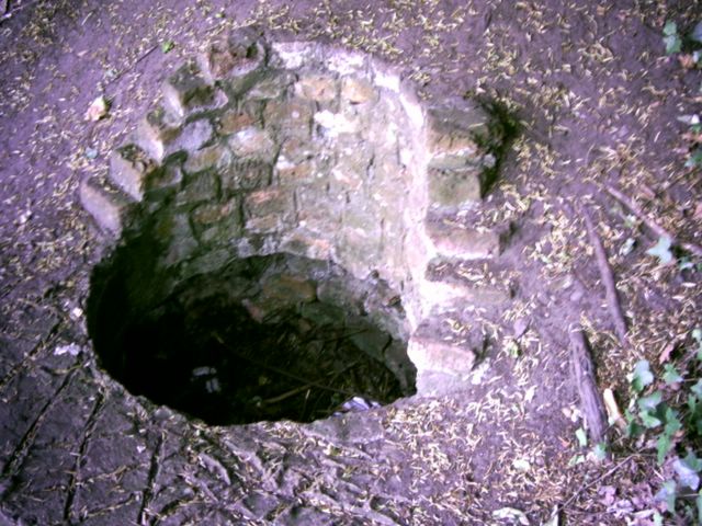
Scadbury moated manor Posted by Picasa Very much a picturesque ruin it needs an artist to paint it. There were two wells, one on the other side of the moat so this must be the well of loneliness.
The well of lonliness? Scadbury Posted by Picasa After seeing this romantic spot I got rather lost in the Oak and Birch woods of Scadbury Park. Eventually I found Paul’s Cray Road and crossed into National Trust land at Pett’s Wood. I looked for and missed the William Willets sundial. Willets was a London builder and madman who wanted more work from his men (according to one story) or who wanted to play golf later in the evening (according to another). Instead of getting up earlier and doing all his work so he could go home early he had the hair brained notion of setting the clocks forward by 80 minutes in summer and back by 80 minutes in autumn. This scheme was later modified and adopted by Lloyd George during the first world war and has continued ever since.

Daylight Saving Time does not save one second of daylight!

The sundial is marked only in Daylight Saving Time.

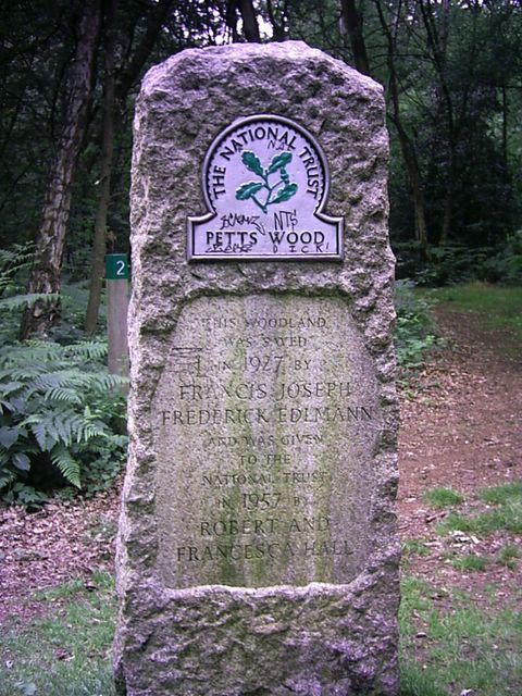
I did see a commemorative stone in Pett’s Wood to the person who prevented development of the wood.
Pett's wood memorial stone Posted by Picasa Pett’s wood has substantial suburban houses as per the picture,
Suburbia - Pett's Wood Posted by Picasa and no doubt substantial suburban residents. The public houses were filled to bursting with football fans so I had a take away from a kebab shop where I got a moderately good kebab.

24 June, 2006

A visit to the Crays

A quick look at St Mary's and St Paul's Cray. Not as interesting as I thought but may edit this later


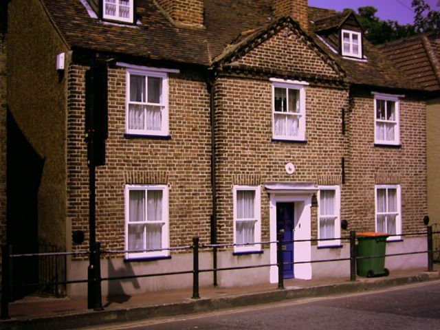
old house St Mary Cray Posted by Picasa

21 June, 2006


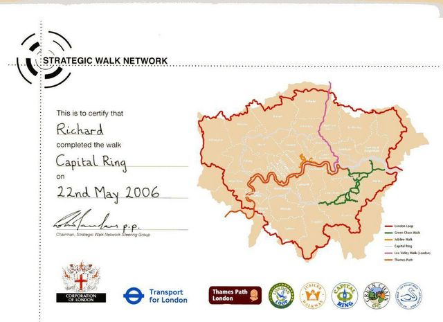
My certificate to show I've completed the ring! Posted by Picasa