31 August, 2006
Why might you want to read my random notes?
Looking around on the web the other day, I came upon the following view, which is attributed to G K Chesterton as the theme in all his work. I think it's a good one. Against the background that nothing might exist - think about that: what if nothing existed? - then everything is interesting. I hope all my readers find this blog is at least in part, interesting.
27 August, 2006
Yiewsley to Moor Park – completed stage 11 and stages 12 and 13 of the London Loop
I resumed walking the loop where I left off last time at Yiewsley outside the superstore there, having been in to pick up my lunch for today. Today was a good walk for photography although my skill with a digicam leaves a lot to be desired – the real photos will be better. One point of note, travelling from Paddington to West Drayton Station I crossed the Wharncliffe Viaduct – do you remember me passing under it on the Capital Ring? I was also going to post pictures of Uxbridge town centre here, but as I didn’t pass through it, I thought better of it. This walk was easy in places and tough in others but there are only 11 stages on the loop left to do!
The first point of interest is the packet boat marina on the Slough Arm of the Grand Union Canal. The Slough Arm was the last canal to be built in this country in the 1880s, and its purpose was to carry bricks to London from the brickfields of Langley. The marina was completed in 2003. Packet boats were boats which carried parcels and passengers (and possibly letters but that would be excessively slow)rather than general cargoes (coal, grain, pottery etc.) which the normal canal boats carried.

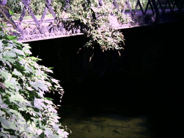
Carrying on up the canal it was strange to find that the canal crossed the river fray via an aqueduct. Looking down to the river, the aqueduct was quite deep and would have made any navigation on the river impossible (it was only a little river). I did notice that the fray had some very large fish in it.

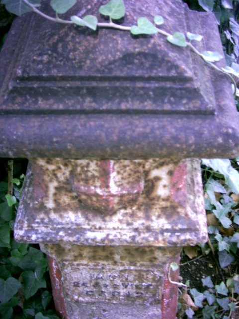
Later on, I came upon a coal tax marker in granite (they were usually cast iron). The act quoted on the marker was an act from Queen Victoria’s day so I will have to look it up and see what it says, although if anybody knows please can they comment. This was not the last coal tax marker I would see although they were not present in the places the book said they should be. At the marker, I crossed the bridge over the canal and passed along some very quiet pathways alongside the River Colne, alas with very few blackberries, but there were plenty of elderberries and I thought I’d share them with you.

The embankments to this path looked like a dumping ground for pottery and there were remains of broken plates and cooking pots around here. There was also much more dubious litter including a bath as I approached Little Britain Lakes. These have nothing to do with the television show but are named because they look like a map of Great Britain. I didn’t have my helicopter with me so I cannot show you a picture of them. I crossed the Colne into Buckinghamshire and walked alongside until I reached road leading to the village of Iver. I crossed the Colne back into Hillingdon and there, just on the bridge, was this coal tax marker.

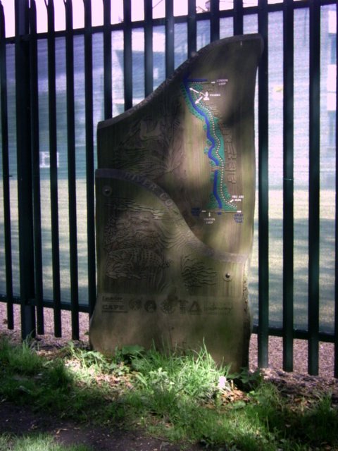
The route then took a hairpin bend past a very large metal insecurity fence that followed the boundary of the Colne Valley Pak, which is marked with these pleasant wooden signs.
After passing through some dull industrial units (noticing one of them was reinforced concrete from the 1950s), I came upon a row of pretty cottages called culvert lane. I also saw a little bridge over the culvert called Church Lane. I came upon a pretty church and National School Group which had all been converted to housing although very tastefully. One could hardly fail to hear a doorbell like the one on the church. Back to the route, I rejoined the Grand Union Canal and walked along, with lots of boats moored here. One of the bridges had a World War II pillbox built in. In the 1940s of course, the canals were still moving goods around and essential to the war effort. In fact, the evacuation seat of government (that had been planned in Napoleonic times) was on the canal network, rather than the railway network. By then it was time to have my lunch so I sat down outside the Swan and Bottle in Uxbridge and had my pie, my fruit and my 25cl bottle of wine, bought especially for the occasion. I had a nice chat with a professional photographer who was trying to make Uxbridge look lovely. I hope he succeeded.
After lunch, I moved up to Uxbridge Lock and opened the gates to allow a boat through. It was interesting to watch the boat sink in the lock and then sail out again. Just after Uxbridge I spotted this paddle boat. It was called Severnake, but I thought it should perhaps be Cotton Blossom (musical buffs will get that).
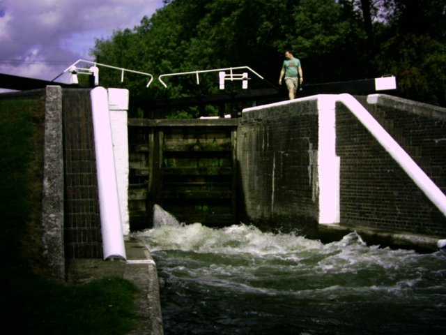
Again carrying on up the Grand Union Canal past Denham Lock where this white water has occurred.
Denham lock is the deepest on the canal which is what causes the white water here when a boat goes through. At Denham Lock, there was a beautiful little tea garden on the banks of the Colne. It looked very pretty. On my way up top cross the canal two boys in a tub boat had got their fishing line snagged on a boat, and I stepped aboard and released it, so I have been on the canal as well as by it. I crossed the canal and wandered by the lakes and marinas of Denham Country Park, passing under a large blue brick viaduct, which I think carries trains to Birmingham via High Wycombe. The lakes are excavated gravel workings. There was another large marina in the park with lots of narrow boats all in a row, with their brightly painted prows and sterns showing off their owners artistic flair. This type of folk art developed to show pictures and creativity when a boatman and his family would live in two small cabins in the stern of the boat. This surely must be an aspect of the life afloat that the boatmen will not miss. I rejoined the canal at Widewater Lock then carried on up to Black Jack’s Mill lock, a reminder of Britain’s days of slavery as Black Jack was a slave who went with the mill. The mill was in a beautiful setting with a mill race. There were also weirs here which were a picture. There are also some beautiful houses here. All good things come to an end and I had to leave the Canal at this point, passing the pub. The loop took me through some more open countryside.
The leaflet calls stage 13 easy walking. I’m not sure that it is though. The first part involves negotiating a very busy road away from the Grand Union Canal and past what used to be a copper mill. Then the path climbs past a row of beautifully kept cottages and through a closely guarded steep path to eventually come out into open fields. Harefield is the highest point in Middlesex (or is that Horsenden Hill that we met on the ring?) and the Middlesex County Tuberculosis Hospital was built here to cash in on the fresh air cure that was the only way of treating the white plague before the discovery of antibiotics. The hospital still performs a useful function today treating cancer patients.
The next stage of the loop was entirely through fields of cattle and maize, the cows kept out of the maize by an electric fence (ouch!). The police helicopter also flew above me. I wonder if they were looking for me?
Harefield road was difficult with speeding cars and no footpath but the Rose and Crown pub at the top served an excellent shandy with good company. The pub is unspoilt and even had an attractive barman to help things along. But one must press on and the next path went through fields until it reached the Bishop’s Wood Country Park where I followed the winding path through the ancient woods. Walking under some high tension electricity pylons I felt like a pioneer. This is a path less travelled and it was very overgrown in places. I just kept the overhead wires in sight and hoped for the best. Eventually I came out at the Olde Greene Manne Pub. Dick Turpin supposedly visited this pub. There was also the Prince of Wales, which was the one if you remember where I had the encounter with the stripper early in the blog. I tore myself away from the delights of public houses to look for another coal tax marker which I couldn’t see, then went on a paved path (or trod), the boundary between Middlesex and Hertfordshire. And that makes three counties I have been in today: Greater London, Buckinghamshire and Hertfordshire. If you count the pre 1889 Counties, I have been in Surrey (at home) and Middlesex too. The path eventually came out by some very nice houses indeed, which Lord Leverhulme (the soap and Margarine king) developed in the 1920s. Moor Park is an anagram of Poor Mark, but there’s nobody here who is poor. The substantial houses in private roads just say untold wealth. Well they probably owe more money than I do anyway. I soon came to the Metropolitan line, and passed under the bridge that carried it. Walking up through the woods to the station was a weary trek but very pleasant.
This is a pretty walk.
The first point of interest is the packet boat marina on the Slough Arm of the Grand Union Canal. The Slough Arm was the last canal to be built in this country in the 1880s, and its purpose was to carry bricks to London from the brickfields of Langley. The marina was completed in 2003. Packet boats were boats which carried parcels and passengers (and possibly letters but that would be excessively slow)rather than general cargoes (coal, grain, pottery etc.) which the normal canal boats carried.

Carrying on up the canal it was strange to find that the canal crossed the river fray via an aqueduct. Looking down to the river, the aqueduct was quite deep and would have made any navigation on the river impossible (it was only a little river). I did notice that the fray had some very large fish in it.
Later on, I came upon a coal tax marker in granite (they were usually cast iron). The act quoted on the marker was an act from Queen Victoria’s day so I will have to look it up and see what it says, although if anybody knows please can they comment. This was not the last coal tax marker I would see although they were not present in the places the book said they should be. At the marker, I crossed the bridge over the canal and passed along some very quiet pathways alongside the River Colne, alas with very few blackberries, but there were plenty of elderberries and I thought I’d share them with you.

The embankments to this path looked like a dumping ground for pottery and there were remains of broken plates and cooking pots around here. There was also much more dubious litter including a bath as I approached Little Britain Lakes. These have nothing to do with the television show but are named because they look like a map of Great Britain. I didn’t have my helicopter with me so I cannot show you a picture of them. I crossed the Colne into Buckinghamshire and walked alongside until I reached road leading to the village of Iver. I crossed the Colne back into Hillingdon and there, just on the bridge, was this coal tax marker.
The route then took a hairpin bend past a very large metal insecurity fence that followed the boundary of the Colne Valley Pak, which is marked with these pleasant wooden signs.
After passing through some dull industrial units (noticing one of them was reinforced concrete from the 1950s), I came upon a row of pretty cottages called culvert lane. I also saw a little bridge over the culvert called Church Lane. I came upon a pretty church and National School Group which had all been converted to housing although very tastefully. One could hardly fail to hear a doorbell like the one on the church. Back to the route, I rejoined the Grand Union Canal and walked along, with lots of boats moored here. One of the bridges had a World War II pillbox built in. In the 1940s of course, the canals were still moving goods around and essential to the war effort. In fact, the evacuation seat of government (that had been planned in Napoleonic times) was on the canal network, rather than the railway network. By then it was time to have my lunch so I sat down outside the Swan and Bottle in Uxbridge and had my pie, my fruit and my 25cl bottle of wine, bought especially for the occasion. I had a nice chat with a professional photographer who was trying to make Uxbridge look lovely. I hope he succeeded.
After lunch, I moved up to Uxbridge Lock and opened the gates to allow a boat through. It was interesting to watch the boat sink in the lock and then sail out again. Just after Uxbridge I spotted this paddle boat. It was called Severnake, but I thought it should perhaps be Cotton Blossom (musical buffs will get that).

Again carrying on up the Grand Union Canal past Denham Lock where this white water has occurred.
Denham lock is the deepest on the canal which is what causes the white water here when a boat goes through. At Denham Lock, there was a beautiful little tea garden on the banks of the Colne. It looked very pretty. On my way up top cross the canal two boys in a tub boat had got their fishing line snagged on a boat, and I stepped aboard and released it, so I have been on the canal as well as by it. I crossed the canal and wandered by the lakes and marinas of Denham Country Park, passing under a large blue brick viaduct, which I think carries trains to Birmingham via High Wycombe. The lakes are excavated gravel workings. There was another large marina in the park with lots of narrow boats all in a row, with their brightly painted prows and sterns showing off their owners artistic flair. This type of folk art developed to show pictures and creativity when a boatman and his family would live in two small cabins in the stern of the boat. This surely must be an aspect of the life afloat that the boatmen will not miss. I rejoined the canal at Widewater Lock then carried on up to Black Jack’s Mill lock, a reminder of Britain’s days of slavery as Black Jack was a slave who went with the mill. The mill was in a beautiful setting with a mill race. There were also weirs here which were a picture. There are also some beautiful houses here. All good things come to an end and I had to leave the Canal at this point, passing the pub. The loop took me through some more open countryside.
The leaflet calls stage 13 easy walking. I’m not sure that it is though. The first part involves negotiating a very busy road away from the Grand Union Canal and past what used to be a copper mill. Then the path climbs past a row of beautifully kept cottages and through a closely guarded steep path to eventually come out into open fields. Harefield is the highest point in Middlesex (or is that Horsenden Hill that we met on the ring?) and the Middlesex County Tuberculosis Hospital was built here to cash in on the fresh air cure that was the only way of treating the white plague before the discovery of antibiotics. The hospital still performs a useful function today treating cancer patients.
The next stage of the loop was entirely through fields of cattle and maize, the cows kept out of the maize by an electric fence (ouch!). The police helicopter also flew above me. I wonder if they were looking for me?
Harefield road was difficult with speeding cars and no footpath but the Rose and Crown pub at the top served an excellent shandy with good company. The pub is unspoilt and even had an attractive barman to help things along. But one must press on and the next path went through fields until it reached the Bishop’s Wood Country Park where I followed the winding path through the ancient woods. Walking under some high tension electricity pylons I felt like a pioneer. This is a path less travelled and it was very overgrown in places. I just kept the overhead wires in sight and hoped for the best. Eventually I came out at the Olde Greene Manne Pub. Dick Turpin supposedly visited this pub. There was also the Prince of Wales, which was the one if you remember where I had the encounter with the stripper early in the blog. I tore myself away from the delights of public houses to look for another coal tax marker which I couldn’t see, then went on a paved path (or trod), the boundary between Middlesex and Hertfordshire. And that makes three counties I have been in today: Greater London, Buckinghamshire and Hertfordshire. If you count the pre 1889 Counties, I have been in Surrey (at home) and Middlesex too. The path eventually came out by some very nice houses indeed, which Lord Leverhulme (the soap and Margarine king) developed in the 1920s. Moor Park is an anagram of Poor Mark, but there’s nobody here who is poor. The substantial houses in private roads just say untold wealth. Well they probably owe more money than I do anyway. I soon came to the Metropolitan line, and passed under the bridge that carried it. Walking up through the woods to the station was a weary trek but very pleasant.
This is a pretty walk.
19 August, 2006
London Loop Walks 10 and 11 (part) Hatton Cross to Yiewsley by hidden pathways.
I think I’ve now decided that I’ll do the Loop in the stages I think I can, not the ones that the organisers have done for me. Today’s walk 10 was far too short to justify the tube fare but 10 and 11 together were too long for a day’s walk, especially after night clubbing the night before (and the possibility of night clubbing the night after too!). Hence the truncated version ending at Yiewsley.
Hatton Cross is the station for Heathrow Terminal 4 and is big on 1960s design. I saw a lot of aircraft from here going into Heathrow although I soon turned off the Great South West Road by a little hidden path following the River Crane into Cranebank Water Meadows. These did not look particularly watery but there was an abundance of blackberries, although these were not as nice as last weeks, and many teasels. There were also large dragonflies around, so close to suburbia. The Crane apparently has oxbow lakes (I am revising primary school geography!) which are caused when a river meander silts up leaving the lake behind as a body of water. I think I saw one but could not be sure.
The Middlesex County Council rebuilt the 18th Century Bridge in 1915 so I crossed the crane into a different parish, as marked on the bridge, and into the borough of Hillingdon. The Berkely Meadows were totally empty of people, even the children’s playground had no children playing. There was a fox running around, and – joy of joys – waymarkers for the loop which Hounslow seemed to have forgotten about last walk.

There was also this sign prohibiting horse riding, erected by a town clerk who forgot that trees grew. Looks like his sign has grown into the tree, proving that man proposes but ultimately G*d disposes. Leaving the pleasant meadows behind into a hazardous lane with speeding traffic I came upon another hidden pathway behind a traffic barrier. I was all excited about venturing into the unknown as this path had a distinctly ‘trespass’ feel about it. I crossed a little plank bridge over a stream and came out into Cranford Park. Cranford lost most of its village in the extension of Heston Airport which we now know as Heathrow. The mansion in Cranford Park was demolished in the 1940s as uninhabitable but the little church of St Dunstan remains. As usual, locked when I called. I didn’t see the church of the Holy Angels but would like to if it still exists. Arthur Mee calls it very modern with a hooter instead of bells! St Dunstans had a family coat of arms for the Berkeleys (who owned the estate) on the East wall and a gravestone with a crude skull and cross bones carved on it.

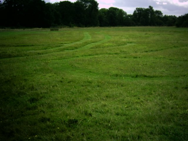
Cranford Park also had this unusual maze cut into the grass. By no means a traditional turf maze it was fun to follow it round. There were one or two more people in this park but I still had the impression it was Friday and everybody was at work. No doubt my boss will tell me if I didn’t go in.

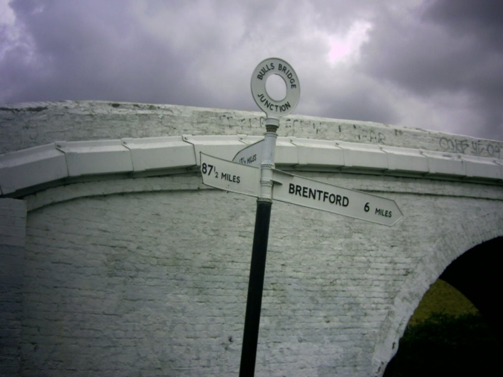
All that is left of the mansion is the stable block, with a clock reputed to have come from Hampton Court (and it was working when I called) and an unusual arrangement of seats set in a hedged enclosure. The stables were closed but are in historic order with many original fittings remaining. Leaving the park by St Dunstan’s Subway which was built to allow parishioners to get to church after the M4 was built, I came into Dog Kennel Covert, a little patch of woodland, which must have been where the mansion’s dogs were kept in olden times. The next point of interest was the Grand Union Canal, where I was greeted by the disgusting smell of coffee coming from the Nescafe factory, on the other bank of the canal. The picture shows the sign giving the distance to Paddington Birmingham and Brentford. Most peculiarly, the canal had water lilies growing in it. I was amazed that they could survive.

Still recalling primary school geography lessons, I had to write a story imagining I was a child on a canal boat on the Grand Union Canal, and how I would do my lessons. The British Waterways boatmen did indeed live with their families on the boats. With the boats gone, a whole waterborne way of life has disappeared. Are they sorry? I don’t know.
I followed the canal to Hayes which is where HMV had their factory in the early 20th Century making 78s and the gramaphones to play them. Arthur Mee says that it is here that melody is made permanent and enduring. Hayes has a pretty library from the early part of the 20th Century but the town itself is not really inspiring. I did not see the old church but there is a 19th century Church (St Anselm) and the large RC church bears the design hallmarks of the 1960s.
Leaving Hayes behind on the Grand Union Canal I came to Stockley Park, with its high tech offices set amongst water features and greenery. The Golf course belongs to Hillingdon Council and the loop passes through Stockley Country Park. Unfortunately this is where it rained and I nearly got soaked but the sun was warm and I dried out. The suspension bridge from one part of the park to the other has this rather curious A shaped pylon.

After a quick look at the view and getting a bit lost in spite of the waymarkers I was soon back on the Grand Union Canal, with relics of old industry on the opposite banks and fishers on the towpath. Coming to Yiewsley I decided I’d walked far enough today (7.3 miles) so got a bus to Uxbridge and a Metropolitan and Jubilee line train home.
Hatton Cross is the station for Heathrow Terminal 4 and is big on 1960s design. I saw a lot of aircraft from here going into Heathrow although I soon turned off the Great South West Road by a little hidden path following the River Crane into Cranebank Water Meadows. These did not look particularly watery but there was an abundance of blackberries, although these were not as nice as last weeks, and many teasels. There were also large dragonflies around, so close to suburbia. The Crane apparently has oxbow lakes (I am revising primary school geography!) which are caused when a river meander silts up leaving the lake behind as a body of water. I think I saw one but could not be sure.
The Middlesex County Council rebuilt the 18th Century Bridge in 1915 so I crossed the crane into a different parish, as marked on the bridge, and into the borough of Hillingdon. The Berkely Meadows were totally empty of people, even the children’s playground had no children playing. There was a fox running around, and – joy of joys – waymarkers for the loop which Hounslow seemed to have forgotten about last walk.

There was also this sign prohibiting horse riding, erected by a town clerk who forgot that trees grew. Looks like his sign has grown into the tree, proving that man proposes but ultimately G*d disposes. Leaving the pleasant meadows behind into a hazardous lane with speeding traffic I came upon another hidden pathway behind a traffic barrier. I was all excited about venturing into the unknown as this path had a distinctly ‘trespass’ feel about it. I crossed a little plank bridge over a stream and came out into Cranford Park. Cranford lost most of its village in the extension of Heston Airport which we now know as Heathrow. The mansion in Cranford Park was demolished in the 1940s as uninhabitable but the little church of St Dunstan remains. As usual, locked when I called. I didn’t see the church of the Holy Angels but would like to if it still exists. Arthur Mee calls it very modern with a hooter instead of bells! St Dunstans had a family coat of arms for the Berkeleys (who owned the estate) on the East wall and a gravestone with a crude skull and cross bones carved on it.

Cranford Park also had this unusual maze cut into the grass. By no means a traditional turf maze it was fun to follow it round. There were one or two more people in this park but I still had the impression it was Friday and everybody was at work. No doubt my boss will tell me if I didn’t go in.
All that is left of the mansion is the stable block, with a clock reputed to have come from Hampton Court (and it was working when I called) and an unusual arrangement of seats set in a hedged enclosure. The stables were closed but are in historic order with many original fittings remaining. Leaving the park by St Dunstan’s Subway which was built to allow parishioners to get to church after the M4 was built, I came into Dog Kennel Covert, a little patch of woodland, which must have been where the mansion’s dogs were kept in olden times. The next point of interest was the Grand Union Canal, where I was greeted by the disgusting smell of coffee coming from the Nescafe factory, on the other bank of the canal. The picture shows the sign giving the distance to Paddington Birmingham and Brentford. Most peculiarly, the canal had water lilies growing in it. I was amazed that they could survive.
Still recalling primary school geography lessons, I had to write a story imagining I was a child on a canal boat on the Grand Union Canal, and how I would do my lessons. The British Waterways boatmen did indeed live with their families on the boats. With the boats gone, a whole waterborne way of life has disappeared. Are they sorry? I don’t know.
I followed the canal to Hayes which is where HMV had their factory in the early 20th Century making 78s and the gramaphones to play them. Arthur Mee says that it is here that melody is made permanent and enduring. Hayes has a pretty library from the early part of the 20th Century but the town itself is not really inspiring. I did not see the old church but there is a 19th century Church (St Anselm) and the large RC church bears the design hallmarks of the 1960s.
Leaving Hayes behind on the Grand Union Canal I came to Stockley Park, with its high tech offices set amongst water features and greenery. The Golf course belongs to Hillingdon Council and the loop passes through Stockley Country Park. Unfortunately this is where it rained and I nearly got soaked but the sun was warm and I dried out. The suspension bridge from one part of the park to the other has this rather curious A shaped pylon.

After a quick look at the view and getting a bit lost in spite of the waymarkers I was soon back on the Grand Union Canal, with relics of old industry on the opposite banks and fishers on the towpath. Coming to Yiewsley I decided I’d walked far enough today (7.3 miles) so got a bus to Uxbridge and a Metropolitan and Jubilee line train home.
14 August, 2006
Walk 9 of the London Loop – Kingston to somewhere horrible in Middlesex
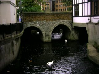
This part of the loop was unsigned which made it difficult and I don’t think I managed to complete it. The day was drizzly which also made walking even more challenging. Kingston is a nice place and I made sure I walked a short part of the previous loop again to photograph the clattern bridge and the Coronation Stone. The coronation stone was where nine of the Saxon kings of England were crowned and the Clattern bridge is a survivor from the 12th Century which crosses the Hogsmill near its confluence with the Thames.
I crossed Kingston Bridge and entered Bushy Park past a small Victorian looking church. I noticed many swallows in the park all flying low because of the rain but Bushy Park is really managed for deer. The loop runs through a delightful woodland garden with ubiquitous rhododendrons and a pretty cottage although I heard shouted swear words through the open windows. This was disconcerting.
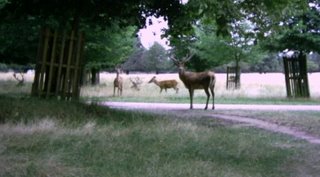
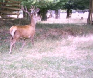
The deer congregated in the next bit of Bushy Park, which was slightly scary as they appeared to be in charge of young but although they were watching me and started when the camera clicked they did not attack although I thought they might. And these were full size deer not the mini-deer of Knole.
Leaving the park I walked into the semi-detatched suburbia of Teddington, and crossing a piece of rough land belonging to a golf course I then went into a thirties housing estate. The street names were Rivermead Avenue (in the seventies the Avenue part would have been dropped) and Bye Ways which sounds like a farewell. The houses were interesting with fully tiled porches and one or two in a very uncompromising modernist style.
This street leads to a main road and the River Crane which on this route one follows upstream. I walked through a scrubby park and along the river, eating wild blackberries all the way. Somebody was even out gathering them which I have not seen for a long time. Wild blackberries can be a bit sour but mixed with apple as a pie filling are delicious.
The river was used to power gunpowder mills and the old watch or water tower still remains from this time. It is called a shot tower but is not really high enough for this purpose. Otherwise the park is dull.
At Hounslow Heath (danger - adders!) I got lost. Looking at a street map it would help if the author know left from right! I eventually walked over a golf course that looked parched with the wet weather. It also looked like golfers had been banned due to the drought as there was nobody playing. Walking up the River Crane again I came to the bridge mentioned in the guide book and crossed it to continue walking by the river through Brazil Mills Wood.
Brazil mills wood eventually leads into Donkey Wood where I got lost again!! Dodging the boys drinking cheap lager, I walked up to cross the Great South West Road and down to the other part of Donkey Wood. I crossed the Duke of Northumberland’s River, that I met at Isleworth on the Capital Ring, perhaps I should not have crossed this as in a few hundred yards crossing a road bridge I came upon the end of the track in a boggy mire at the River Crane. The path was truly impassable without a boat.
Sunbury on Thames
I caught a bus to Sunbury on Thames from where I ended the walk. Apparently there had been a regatta on the river that day which I had missed. However there was a curious church with an eighteenth century tower and a nineteenth century Italianate basilica and apse. It was a most peculiar combination, and although I am reluctant to use this word, very slightly unpleasant. However there was a very pleasant walled garden there, and the riverside but not much else. I went back to Sunbury Cross, had a drink of water from the coöp and went back home. A mixed day.

I crossed Kingston Bridge and entered Bushy Park past a small Victorian looking church. I noticed many swallows in the park all flying low because of the rain but Bushy Park is really managed for deer. The loop runs through a delightful woodland garden with ubiquitous rhododendrons and a pretty cottage although I heard shouted swear words through the open windows. This was disconcerting.
The deer congregated in the next bit of Bushy Park, which was slightly scary as they appeared to be in charge of young but although they were watching me and started when the camera clicked they did not attack although I thought they might. And these were full size deer not the mini-deer of Knole.


Leaving the park I walked into the semi-detatched suburbia of Teddington, and crossing a piece of rough land belonging to a golf course I then went into a thirties housing estate. The street names were Rivermead Avenue (in the seventies the Avenue part would have been dropped) and Bye Ways which sounds like a farewell. The houses were interesting with fully tiled porches and one or two in a very uncompromising modernist style.

This street leads to a main road and the River Crane which on this route one follows upstream. I walked through a scrubby park and along the river, eating wild blackberries all the way. Somebody was even out gathering them which I have not seen for a long time. Wild blackberries can be a bit sour but mixed with apple as a pie filling are delicious.
The river was used to power gunpowder mills and the old watch or water tower still remains from this time. It is called a shot tower but is not really high enough for this purpose. Otherwise the park is dull.
At Hounslow Heath (danger - adders!) I got lost. Looking at a street map it would help if the author know left from right! I eventually walked over a golf course that looked parched with the wet weather. It also looked like golfers had been banned due to the drought as there was nobody playing. Walking up the River Crane again I came to the bridge mentioned in the guide book and crossed it to continue walking by the river through Brazil Mills Wood.
Brazil mills wood eventually leads into Donkey Wood where I got lost again!! Dodging the boys drinking cheap lager, I walked up to cross the Great South West Road and down to the other part of Donkey Wood. I crossed the Duke of Northumberland’s River, that I met at Isleworth on the Capital Ring, perhaps I should not have crossed this as in a few hundred yards crossing a road bridge I came upon the end of the track in a boggy mire at the River Crane. The path was truly impassable without a boat.
Sunbury on Thames
I caught a bus to Sunbury on Thames from where I ended the walk. Apparently there had been a regatta on the river that day which I had missed. However there was a curious church with an eighteenth century tower and a nineteenth century Italianate basilica and apse. It was a most peculiar combination, and although I am reluctant to use this word, very slightly unpleasant. However there was a very pleasant walled garden there, and the riverside but not much else. I went back to Sunbury Cross, had a drink of water from the coöp and went back home. A mixed day.
06 August, 2006
Brighton and the Wagners
Worship the Lord in the beauty of holiness
I spent the weekend of the Transfiguration in Brighton on the Sussex coast, Many thanks to Mike and Tony for kind hospitality.
Brighton may not seem like a setting for religious controversy but in the 19th Century the Church of England in Brighton became one of the main proponents of what has become known as 'Anglo-Catholicism' but is more properly known as ceremonialism or ritualism. Ceremonialism was a force for renewal of the spiritual life of the nation as expressed by the Church of England. Ceremonialists considered that the church of England was part of the universal (catholic) church but not part of the church of Rome. The story in Brighton begins with the vicar of Brighton, Rev'd Henry Wagner who built a church, St Pauls, for his son, Rev'd Arthur Wagner. Arthur Wagner introduced ceremonialism to the congregations of Brighton and eventually opened five churches all in poor districts as well as extablishing communities of (church of England) nuns, to act as welfare workers. He also built houses for poor people to live in.
Concern for the poor and opressed has always been part of the ceremonialist agenda. Not simply the warmth of the ritual and the good order of the church attracted those who lived without beauty in dismal hovels, abolishing pew rents allowed poor people to take part in the service. In Thaxted (Essex) the Rev'd Conrad Noel raised the Red Flag to show solidarity with workers everywhere.
Arthur Wagner worked in Brighton for 52 years and was shot at in the street because he refused to disclose to a court what a penitent, who was on trial for murdering her child, had told him in confession.
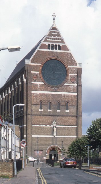
I went to the morning service at St Bartholemew's, a Wagner church built in 1872 to the exact dimensions of Noah's Ark to serve railway workers in the nearby tiny dwellings. It dominates the town. Inside there are tractarian chairs (The first church in Brighton to abolish pew rents) and a beautiful mosaic reredos which looked as though it had been cleaned since I was last in there. The gold halos shone in the light. We had Solemn high mass with the Angelus. Being in this church has been described as being in heaven. I wouldnt go that far but it's pretty near. The picture shows the liturgical west front.

I went to Evening prayer with Benediction of the Blessed Sacrament at St Pauls, the one Henry Wagner built for his son. This church which is in a restrained gothic style is currently undergoing some restoration. There were pews rather than tractarian chairs, although this church was before that movement really began. The tiled floor was slightly incongruous and was not really suitable for a school hall. Then again the dull quarry tiles underneath were worse. A very nice service
Most churches of the Church of England have now adopted more or fewer of these ceremonialist reforms as policy, for example most communion tables in the Church of England are now in the chancel rather than the nave, and have their long sides facing east-west instead of north-south as required by the prayer book.
Brighton Pride was also on that weekend. I was a climate commando with the Coöperative group. It was good to see old friends again.
Again I was taking names for the membership and it was good to meet a few people who were members of the society already.
I also had a go on our climbing wall but only got about two feet!
On Sunday afternoon Mike Tony and I had a drive out to see the home store and others at Tunbridge Wells and had a beer in Lewes. A most satisfactory weekend.
I spent the weekend of the Transfiguration in Brighton on the Sussex coast, Many thanks to Mike and Tony for kind hospitality.
Brighton may not seem like a setting for religious controversy but in the 19th Century the Church of England in Brighton became one of the main proponents of what has become known as 'Anglo-Catholicism' but is more properly known as ceremonialism or ritualism. Ceremonialism was a force for renewal of the spiritual life of the nation as expressed by the Church of England. Ceremonialists considered that the church of England was part of the universal (catholic) church but not part of the church of Rome. The story in Brighton begins with the vicar of Brighton, Rev'd Henry Wagner who built a church, St Pauls, for his son, Rev'd Arthur Wagner. Arthur Wagner introduced ceremonialism to the congregations of Brighton and eventually opened five churches all in poor districts as well as extablishing communities of (church of England) nuns, to act as welfare workers. He also built houses for poor people to live in.
Concern for the poor and opressed has always been part of the ceremonialist agenda. Not simply the warmth of the ritual and the good order of the church attracted those who lived without beauty in dismal hovels, abolishing pew rents allowed poor people to take part in the service. In Thaxted (Essex) the Rev'd Conrad Noel raised the Red Flag to show solidarity with workers everywhere.
Arthur Wagner worked in Brighton for 52 years and was shot at in the street because he refused to disclose to a court what a penitent, who was on trial for murdering her child, had told him in confession.
I went to the morning service at St Bartholemew's, a Wagner church built in 1872 to the exact dimensions of Noah's Ark to serve railway workers in the nearby tiny dwellings. It dominates the town. Inside there are tractarian chairs (The first church in Brighton to abolish pew rents) and a beautiful mosaic reredos which looked as though it had been cleaned since I was last in there. The gold halos shone in the light. We had Solemn high mass with the Angelus. Being in this church has been described as being in heaven. I wouldnt go that far but it's pretty near. The picture shows the liturgical west front.
I went to Evening prayer with Benediction of the Blessed Sacrament at St Pauls, the one Henry Wagner built for his son. This church which is in a restrained gothic style is currently undergoing some restoration. There were pews rather than tractarian chairs, although this church was before that movement really began. The tiled floor was slightly incongruous and was not really suitable for a school hall. Then again the dull quarry tiles underneath were worse. A very nice service
Most churches of the Church of England have now adopted more or fewer of these ceremonialist reforms as policy, for example most communion tables in the Church of England are now in the chancel rather than the nave, and have their long sides facing east-west instead of north-south as required by the prayer book.
Brighton Pride was also on that weekend. I was a climate commando with the Coöperative group. It was good to see old friends again.
Again I was taking names for the membership and it was good to meet a few people who were members of the society already.
I also had a go on our climbing wall but only got about two feet!
On Sunday afternoon Mike Tony and I had a drive out to see the home store and others at Tunbridge Wells and had a beer in Lewes. A most satisfactory weekend.
Subscribe to:
Posts (Atom)