The first point of interest is the packet boat marina on the Slough Arm of the Grand Union Canal. The Slough Arm was the last canal to be built in this country in the 1880s, and its purpose was to carry bricks to London from the brickfields of Langley. The marina was completed in 2003. Packet boats were boats which carried parcels and passengers (and possibly letters but that would be excessively slow)rather than general cargoes (coal, grain, pottery etc.) which the normal canal boats carried.

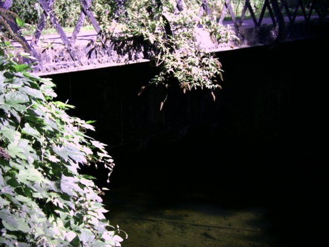
Carrying on up the canal it was strange to find that the canal crossed the river fray via an aqueduct. Looking down to the river, the aqueduct was quite deep and would have made any navigation on the river impossible (it was only a little river). I did notice that the fray had some very large fish in it.
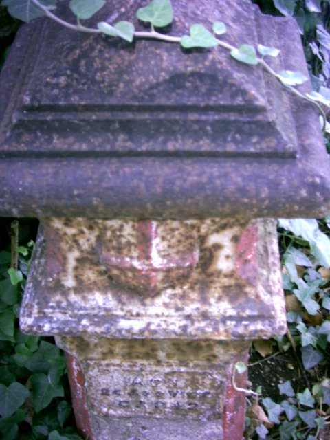
Later on, I came upon a coal tax marker in granite (they were usually cast iron). The act quoted on the marker was an act from Queen Victoria’s day so I will have to look it up and see what it says, although if anybody knows please can they comment. This was not the last coal tax marker I would see although they were not present in the places the book said they should be. At the marker, I crossed the bridge over the canal and passed along some very quiet pathways alongside the River Colne, alas with very few blackberries, but there were plenty of elderberries and I thought I’d share them with you.

The embankments to this path looked like a dumping ground for pottery and there were remains of broken plates and cooking pots around here. There was also much more dubious litter including a bath as I approached Little Britain Lakes. These have nothing to do with the television show but are named because they look like a map of Great Britain. I didn’t have my helicopter with me so I cannot show you a picture of them. I crossed the Colne into Buckinghamshire and walked alongside until I reached road leading to the village of Iver. I crossed the Colne back into Hillingdon and there, just on the bridge, was this coal tax marker.

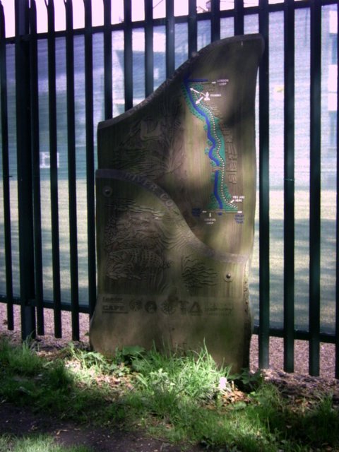
The route then took a hairpin bend past a very large metal insecurity fence that followed the boundary of the Colne Valley Pak, which is marked with these pleasant wooden signs.
After passing through some dull industrial units (noticing one of them was reinforced concrete from the 1950s), I came upon a row of pretty cottages called culvert lane. I also saw a little bridge over the culvert called Church Lane. I came upon a pretty church and National School Group which had all been converted to housing although very tastefully. One could hardly fail to hear a doorbell like the one on the church. Back to the route, I rejoined the Grand Union Canal and walked along, with lots of boats moored here. One of the bridges had a World War II pillbox built in. In the 1940s of course, the canals were still moving goods around and essential to the war effort. In fact, the evacuation seat of government (that had been planned in Napoleonic times) was on the canal network, rather than the railway network. By then it was time to have my lunch so I sat down outside the Swan and Bottle in Uxbridge and had my pie, my fruit and my 25cl bottle of wine, bought especially for the occasion. I had a nice chat with a professional photographer who was trying to make Uxbridge look lovely. I hope he succeeded.
After lunch, I moved up to Uxbridge Lock and opened the gates to allow a boat through. It was interesting to watch the boat sink in the lock and then sail out again. Just after Uxbridge I spotted this paddle boat. It was called Severnake, but I thought it should perhaps be Cotton Blossom (musical buffs will get that).

Again carrying on up the Grand Union Canal past Denham Lock where this white water has occurred.
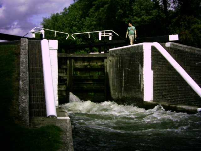
Denham lock is the deepest on the canal which is what causes the white water here when a boat goes through. At Denham Lock, there was a beautiful little tea garden on the banks of the Colne. It looked very pretty. On my way up top cross the canal two boys in a tub boat had got their fishing line snagged on a boat, and I stepped aboard and released it, so I have been on the canal as well as by it. I crossed the canal and wandered by the lakes and marinas of Denham Country Park, passing under a large blue brick viaduct, which I think carries trains to Birmingham via High Wycombe. The lakes are excavated gravel workings. There was another large marina in the park with lots of narrow boats all in a row, with their brightly painted prows and sterns showing off their owners artistic flair. This type of folk art developed to show pictures and creativity when a boatman and his family would live in two small cabins in the stern of the boat. This surely must be an aspect of the life afloat that the boatmen will not miss. I rejoined the canal at Widewater Lock then carried on up to Black Jack’s Mill lock, a reminder of Britain’s days of slavery as Black Jack was a slave who went with the mill. The mill was in a beautiful setting with a mill race. There were also weirs here which were a picture. There are also some beautiful houses here. All good things come to an end and I had to leave the Canal at this point, passing the pub. The loop took me through some more open countryside.
The leaflet calls stage 13 easy walking. I’m not sure that it is though. The first part involves negotiating a very busy road away from the Grand Union Canal and past what used to be a copper mill. Then the path climbs past a row of beautifully kept cottages and through a closely guarded steep path to eventually come out into open fields. Harefield is the highest point in Middlesex (or is that Horsenden Hill that we met on the ring?) and the Middlesex County Tuberculosis Hospital was built here to cash in on the fresh air cure that was the only way of treating the white plague before the discovery of antibiotics. The hospital still performs a useful function today treating cancer patients.
The next stage of the loop was entirely through fields of cattle and maize, the cows kept out of the maize by an electric fence (ouch!). The police helicopter also flew above me. I wonder if they were looking for me?
Harefield road was difficult with speeding cars and no footpath but the Rose and Crown pub at the top served an excellent shandy with good company. The pub is unspoilt and even had an attractive barman to help things along. But one must press on and the next path went through fields until it reached the Bishop’s Wood Country Park where I followed the winding path through the ancient woods. Walking under some high tension electricity pylons I felt like a pioneer. This is a path less travelled and it was very overgrown in places. I just kept the overhead wires in sight and hoped for the best. Eventually I came out at the Olde Greene Manne Pub. Dick Turpin supposedly visited this pub. There was also the Prince of Wales, which was the one if you remember where I had the encounter with the stripper early in the blog. I tore myself away from the delights of public houses to look for another coal tax marker which I couldn’t see, then went on a paved path (or trod), the boundary between Middlesex and Hertfordshire. And that makes three counties I have been in today: Greater London, Buckinghamshire and Hertfordshire. If you count the pre 1889 Counties, I have been in Surrey (at home) and Middlesex too. The path eventually came out by some very nice houses indeed, which Lord Leverhulme (the soap and Margarine king) developed in the 1920s. Moor Park is an anagram of Poor Mark, but there’s nobody here who is poor. The substantial houses in private roads just say untold wealth. Well they probably owe more money than I do anyway. I soon came to the Metropolitan line, and passed under the bridge that carried it. Walking up through the woods to the station was a weary trek but very pleasant.
This is a pretty walk.


No comments:
Post a Comment